£275
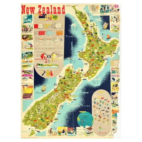
Travel Poster New Zealand Illustrated Map. Original vintage travel poster for New Zealand, featuring a great colourful pictorial map of North, South and Stewart islands, surrounded by the Pacific Ocean, with informative insets with statistics on the population, birth rate, infant death rate, life expectancy, education, livestock population, value of production 1949-1950, trade in 1950, geographical features, comparison of populations of New Zealand and United Kingdom; image insets showing the map of New Zealand, Treaty of Waitangi, kiwi bird, Parliament, sub-tropical trees, tuatara, mountaineers, Maori canoe prow, war effort, major places of interest and a key to the pictorial map. Produced by Publicity Division, Department of Tourism and Publicity, N.Z. Government. Printed in Great Britain. Poor condition, several paper losses on right edge, creasing, tears. Country of issue: UK, designer: H. Mallitte, size (cm): 102x75, year of printing: 1951.
Fees apply to the hammer price:
Room and Absentee Bids:
20% inc VAT*
Online and Autobids:
20% inc VAT*